UPDATE: This Hi Hat proposal received a unanimous recommendation from the Sarasota County Planning Commission on January 21, 2021. The vote was 8-0, the project will now go on to the Board of County Commissioners for official consideration.
The Planning Commission meeting is now available here.
======
Perhaps the largest development project Sarasota County will see in a long time - Hi Hat Ranch - comes before the Planning Commission Thursday Jan. 21. According to Miakka Community advocate Becky Ayech, not only is this plan vague and counter-rational, it' will also change "THE WHOLE ECOSYSTEM."
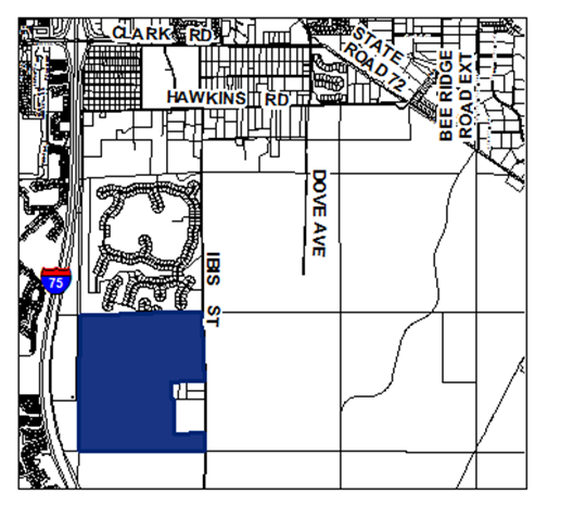
The project takes in 10,000 acres stretching from Fruitville Road to Clark Road. Proposal calls for 13,000 residences with a 30-year build-out.
 |
| Hi Hat Ranch |
Below are resources for comments to the PC from Ayech of the Miakka Community Group - feel free to write to the planning commissioners using any of the information below.
==
PLEASE USE ANY OF THESE COMMENTS. REMEMBER, this is quasi-judicial, so only facts, not opinions.
PLEASE ACT IMMEDIATELY
For example: my water quality has greatly diminished since I moved into my home..HI Hat cannot use their irrigation wells for back up lawn watering. my well is my only source of all my water needs.
RE; HI HAT RANCH DOCC and MASTER DEVELOPMENT PLAN
Good day Planning Commissioners,
The Applicant, Hi Hat Ranch has provided you with a plethora of information.
Unfortunately, one criterial piece of information is missing and many of the guarantees hinge upon that information.
While many maps were provided, the map showing where the Villages are going to be located is not clear at all. I understand there may be 3 or 4 Villages, but I could not find a map that so indicates the locations.
Much of the information provided is relative to the timing of the Villages, specifically infrastructure, discussing the incremental development of utilities
The Applicant has indicated that the first Village would be located at the Hi Hat Ranch offices. This location is akin to a hole in the doughnut. The road to the offices is located on Fruitville Road, 2.1 miles from the Ranch’s western boundary. It would be safe to say this would most likely be the same distance from Bee Ridge Road. This would necessitate running utilities’ lines either from the Bee Ridge Road facilities or from the extension of utilities out to the Hamlet known as Lakepark Estates. This would be ‘leaping’ over lands where it would make more planning sense to begin the Villages and then move easterly.
Therefore, the responses provided discussing these phasing approaches is meritless.
The MDP MUST show the location of at least the first Village
WATER QUALITY
The Applicant has provided information on monitoring and testing the SURFACE water quality, but is offering nothing for ground water protection.
The Applicant has several wells for the agricultural operation (see attached Water Use Permit). The Applicant is purporting to use these ag wells as back up wells for lawn irrigation, if the back up lakes and stormwater ponds fail and that is only after the reclaimed water is not available.
The agricultural wells MUST NOT be used as the third way to water lawns. Existing legal users that are in the Hi Hat Ranch area only have their domestic wells to meet ALL their needs.
Many of the wells on Hi Hat are drilled deep and cased shallow, allowing upward migration of poor-quality water, when then moves laterally into domestic wells. (See attached minutes from the Southwest Florida Water management District Governing Board {SWFWMD] meeting. And well construction records from Sarasota Health Department)
The Ranch is located in the SWFWMD’s Southern Use Water Caution Area (SWUCA) where ground water withdrawals are not only causing upward migration of poor-quality water but also saltwater intrusion. The proper plugging and abandonment of these wells would help the existing legal domestic well users and the Florida Aquifer and the Arcadian Aquifer.
ENVIRONMENTAL PROTECTION
The Applicant stated that the aggregate mining will continue, not only for financial reasons, but because the development will need the fill.
There are NO NATURAL LAKES on the property. While ultimately, they will provide nice lake front property, this changes the whole ecosystem. Species that are currently not on the property will be drawn to the large water source. These may include predator species that would kill exiting species. The flora and fauna would change as well and again the existing flora and fauna support a myriad of species which may not be able to utilize the deep water.
Recognition MUST be given to the potential species changes and plans MUST be provided to show how this change would be mitigated.
The Applicant states they will create new wetlands by scraping off the top soil and importing the appropriate wetland soils. Healthy, thriving wetlands need a hydrological regime.
The Applicant did not provide data and information on sites where this type of creation was successful not data showing how many have failed. There wasn’t any information provided to show how the hydrological needs of the wetlands would be met. In phosphate mining, as an example, wetlands the mitigate are held to a hydrological regime that is artificially maintained by the phosphate company until they are released as ‘successful’ by DEP.
The Applicant must show how they are going to accomplish this wetland scrape land and create a new wetland scheme.
TRAFFIC
During the Workshop and then in a smaller meeting, the Applicant lamented the ugliness of the approach to the Mai Entrance to the Villages from extending Bee Ridge Road, forcing residents to pass the County’s Water Treatment Plant, the Hazardous Waste Collection Facility, the Animal Shelter and Rothenbach Park. He stated the roadway in this area would have to be realigned and that the Applicant would have to build a bridge across Cow Pen Slough.
An alternative road, with a beautiful country (at least for now) view would be to use the existing road leading into the Ranch from Fruitville Road. This would add additional congestion to an already over taxed, constrained scenic road.
Again, this is why at least the first Village should be located on the western boundary of the Ranch and should so be indicated on the map.
DO NOT ADOPT THE MASTER PLAN AND DEVELOPMENT ORDER FOR HI HAT RANCH UNTIL THESE ISSUES HAVE BEEN ADDRESSED.
Thank you.
Respectfully submitted,
Becky Ayech
President
Miakka Community Club
====================================
More from the Herald Tribune
More from this blog on Hi Hat
Four Housing Projects that will overrun Northeast Sarasota
====================================
The emails of the Planning Commissioners:
Andrew.Stultz@sarasotaadvisory.net, Colin.Pember@sarasotaadvisory.net,
Kevin.Cooper@sarasotaadvisory.net, Laura.Benson@sarasotaadvisory.net, Justin.Taylor@sarasotaadvisory.net,
Neil.Rainford@sarasotaadvisory.net, Frank.Strelec@sarasotaadvisory.net, Teresa.Mast@sarasotaadvisory.net,
Drew.Peters@sarasotaadvisory.net