Showing posts with label critical area plan. Show all posts

Friday, October 4, 2019

Comment on Critical Area Plan for the Quad Parcels at the Celery Fields - #2

October 4, 2019

Mr. Steve Kirk
Sarasota County
Planning and Development Services
1660 Ringling Blvd.
Sarasota, FL

Re:  Critical Area Plan for the Palmer Blvd./Quads Area

Dear Mr. Kirk,

I appreciate your compiling the diverse attributes of my neighborhood and laying out some interpretations in the Critical Area Plan draft.  This is indeed a grand undertaking, and I’m sure you’ve put in many hours!

I see: Adopted in 1985, the CAP was privately initiated and required to meet the provisions of the Comprehensive Plan to map the designated industrial area. 

Click to enlarge
I would be curious to know who initiated this CAP, and if these “players” are still around today.  Even back then, you would think any plan would be publicly initiated.

The draft outlines the zoning districts listed below. I believe Figure 5 should have widened the territory to include a much larger view, and the acreages should be given for residential in the wider area.

The following zoning districts (Figure 5) and acreages exist within the CAP:
  •  PID (Planned Industrial Development) - 167.4
  •  ILW (Industrial, Light Manufacturing and Warehousing) - 75
  •  OUR (Open Use Rural) (Quad’s parcels) - 55.2
  •  PED (Planned Economic Development) (SPA 3) - 29
  •  GU (Government Use) (Ackerman Park, fire station) - 30.2
  •  OUE-1 (Open Use Estate) (stormwater pond) - 15.7
  •  PCD (Planned Commerce Development) - 12.3

Some of the recommended permitted uses should be prohibited, such as the following:
  • Light Industrial (there is enough current capacity in the industrial parks)
  • Office                                                    
  • Research laboratory
  • Warehouse and freight movement
  • Wholesale trade
  • Vocational, trade or business school
  • College or university
  • Vehicle service
  • Sale of vehicle parts and accessories
  • Sale of lumber and building supplies
Implementing Zoning Districts

The Comprehensive Plan identifies the implementing zoning districts for each future land use designation. The following are the implementing zoning districts identified for the MEC designation:
  •  ILW (Industrial Light Manufacturing & Warehousing)
  •  IR (Industrial Research)
  •  PCD (Planned Commerce District) (Planned District)
  •  PED (Planned Economic Development) (Planned District)
  •  GU (Government Use)
Also, I disagree with this recommendation:

N.W. and S.W. Quads
Industrial / Office - Suitable
  • Consistent with Comprehensive Plan and surrounding uses.
  •  Low traffic generator
  •  Retains MEC land in employment use.
An additional zoning district should be added to the UDC: Parks and Recreation.  I think that this should be recommended rather than the blanket MEC.

Just as the City of Sarasota is looking at amending zoning to create this set-apart district, Sarasota County should have such a zoning district.

TRAFFIC AND TRANSPORTATION

I do not see any solicitation of opinions from public/private/charter schools regarding student transportation needs.  Would you please reach out to some entities for input?

Center Road and Lorraine Road

The completion of the gap in Center Road between Fruitville Road and Palmer Boulevard should be considered to generally improve connectivity in the area of the CAP and complete a mobility loop through the CAP and around the Celery Fields. Alternatively, the construction of a pedestrian/bike path in the area of this gap could be considered.

The Critical Area Plan for this area necessarily involves a discussion of the
extension of Lorraine Road from Palmer Boulevard to Fruitville.  Also, traffic on Palmer from Lorraine to Debrecen will soon be “F” LOS, from Debrecen to Fruitville “F”, and from Debrecen to Lorraine on Fruitville “F” (per traffic engineer Kwamena Sankah).  Why does this matter?  Because traffic that can’t get to Fruitville will even more clog the Apex area.

Traffic studies – current and anticipatory – are notoriously flawed.  It’s impossible to believe studies will approach reality.  They haven’t in the past, and that will be the future story.
Mitigating Improvements Section 3, Mobility, of this study indicated that the improvements associated with the Cattlemen Road Construction Phase II project and the construction of a roundabout or signalization of the Apex Road and Palmer Boulevard intersection will improve the roadway level of service (LOS) in the area. However, the LOS for that section of Palmer Boulevard west of Apex Road will likely continue to be below the adopted LOS. Also, identified as a mitigating improvement is the expansion to 4 lanes of Palmer Boulevard from Porter Road to Apex Road. However, that expansion would conflict with the objective of preserving the existing character of Palmer Boulevard with its open corridor and roadway section also identified in this study. With the development of any of the Quads parcels, Transportation Planning will identify certain improvements such as turn lanes that will be required to accommodate the traffic generated by a proposed use.
There really is no use that won’t increase traffic and ruin the larger neighborhood character.   Keep in mind that identified capital project needs require funding of $1.2 billion.  Where will money come from for creative roadway improvements that will serve the community in a respectful way?

Public/Civic – Suitable  - Agree – but what?
  • Allowed as part of mixed use in PCD and PED. Limited to 50% of PCD. Traditional town center design requirements must be met in PED. N.W. Quad may be too small for PED design requirements
  • No limitations in GU district.
The public has clearly spoken about public uses, so there is no lack of input there. Any use should be put to the public test, with open communication.  Any government uses (Natural History Museum?) should be also put to the public test.

Sincerely,

Glenna Blomquist

Friday, June 14, 2019

Vision of a Rural Heritage Conservation links Quads and Celery Fields and lands to the East


Courtesy of the Sarasota News Leader

Subscribe to the SNL


Community residents working with Conservation Foundation of Gulf Coast to purchase and preserve 23-acre parcel near Celery Fields


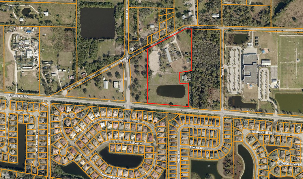
An aerial map shows the location of Graceland Ranch, outlined in red, just west of Tatum Ridge Elementary School. Image from the Sarasota County Property Appraiser’s Office

As debate continues at the Sarasota County Commission dais about the future of county property adjacent to the Celery Fields, the Conservation Foundation of the Gulf Coast is at work on an initiative to create a Rural Heritage Conservation Area in the same vicinity.
A big key to the nonprofit’s plan is the proposed acquisition of a 23.4-acre parcel located off Palmer Boulevard, east of the Celery Fields.
In a June 12 telephone interview with The Sarasota News Leader, Christine Johnson, president of the Conservation Foundation of the Gulf Coast, explained that it had only been a week since the nonprofit had launched its campaign to raise a total of $2,550,000 to buy the privately owned property known as Graceland Ranch.
Residents of the community approached the Foundation, she said, asking, “‘Is there anything you can do?’” They had learned that developers were interested in the Graceland site, Johnson continued, and they wanted to see it remain in a natural state, in keeping with the Celery Fields.
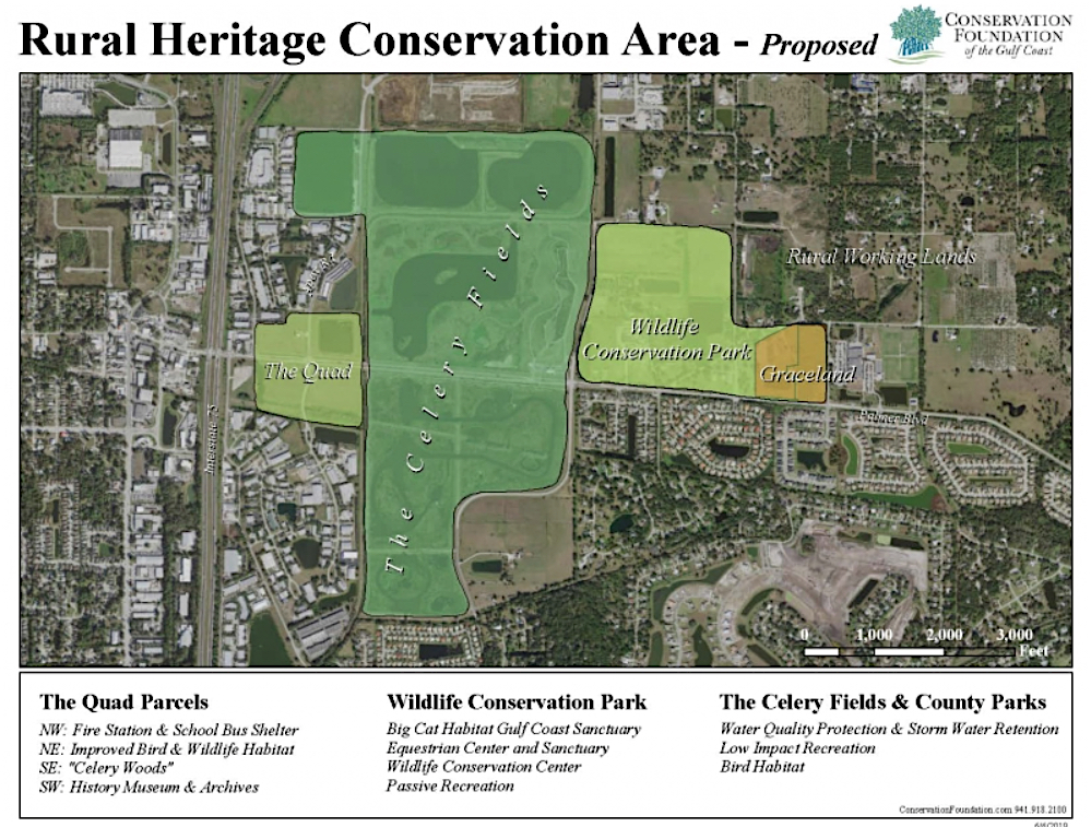
“Graceland is the linchpin to establish a 140-acre wildlife conservation park within a 1,300 acre rural heritage area,” the Foundation says on its website. The property “already is contributing to our community’s quality of life. Graceland provides habitat for wildlife in forested wetlands as well asrecreational opportunities like therapeutic horseback riding and outdoor activities for our youth. This rural heritage area serves as an attractor for visitors and as an amenity for those who live, work and play in Sarasota and Manatee Counties.”

This graphic shows the Rural Heritage Conservation Area the Conservation Foundation of the Gulf Coast envisions with the Graceland Ranch property, Big Cat Habitat, the Celery Fields and the county’s ‘Quads’. Image courtesy Conservation Foundation of the Gulf Coast

The Facebook page for Graceland Ranch notes that the property is located at 7360 Rim Road in Sarasota, just west of Tatum Ridge Elementary School.
Johnson told the News Leader that the Foundation began negotiating with the owner of Graceland Ranch about two months ago. Information the Foundation had received, she said, indicated that two different developers were interested in the land, “nibbling around the edges.” One of those, she continued, seemed pretty serious about constructing approximately 40 homes on the site, even though the land is not zoned for such development.
(The Sarasota County Property Appraiser’s Office says the land is zoned Open Use Rural (OUR). The county’s zoning regulations explain, “The OUR District is intended to retain the open character of the land. This district is further intended for agricultural purposes and uses, and to preserve lands with agricultural development potential. Agriculturally-oriented residential development is encouraged, and all commercial and industrial development is prohibited. … Permitted uses are limited to conservation, agriculture, very low density residential development, recreation, and with certain limitations, other uses that are not contrary to the open character of the district.”)
The owners of Graceland Ranch chose to accept the Conservation Foundation’s offer of an option to purchase the site, Johnson said. Still, she stressed, “It’s really going to be a matter of whether the community wants to save this piece of property.”
The Foundation website makes it clear that the nonprofit needs $650,000 in donations by June 30, with another $650,000 due by Sept. 30 “in order to meet our contract deposits, demonstrate community support, and keep this opportunity, this one-time chance, alive.”
Any person interested in helping with the acquisition can click on a button on the Conservation Foundation website and go directly to a webpage offering a series of steps for making a contribution.

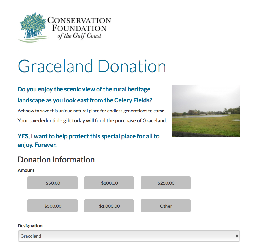
This is part of the webpage that allows an person to make a contribution to the Graceland Ranch acquisition fund. mage courtesy Conservation Foundation of the Gulf Coast

Gifts are tax-deductible, the webpage points out.
‘We save the land’ 
During the June 10 meeting of the Sarasota County Council of Neighborhood Associations (CONA), Debi Osborne, director of land protection for the Conservation Foundation, sought support for the Graceland initiative.
“We save land,” she told the audience members. “We save it forever.”
In the case of Graceland Ranch, she continued, Foundation staff members are working “with willing sellers who are interested in conserving their land …”
If the Foundation is successful in acquiring the property, Osborne continued, “That would then hold the line for the type of more high-density development that’s south of Palmer [Boulevard].”
“We see this as a community effort,” she added.
Sarasota Audubon leaders also are encouraging the public to help save Graceland Ranch from development.

Christine Johnson. mage courtesy Conservation Foundation of the Gulf Coast

An email blast they sent out on June 7 said, “To all Audubon members and those who cherish retaining as much of our environmental lands as we can, the Conservation Foundation of the Gulf Coast is taking the lead in protecting the lands east of the Celery Fields. This foresighted move is in addition to the conservation efforts by Sarasota Audubon, Fresh Start and all residents around the Celery Fields with regard to the [Quads] … If successful, imagine the scope of the protected lands around the Celery Fields! This would ensure a safe environment for the 246 species of birds, as well as all other forms of wildlife in the area. It’s a must for us all to help right now.”
The email encouraged people to donate to the Foundation.
The Fresh Start group mentioned in the Sarasota Audubon email is the same organization that worked with county staff last year — with the support of the County Commission — to propose potential passive uses of the county’s four Quads parcels next to the Celery Fields. Comprising representatives of 50 homeowner associations in the area around the Celery Fields, the Fresh Start Initiative sought to convince the commissioners to focus on long-range planning for the Quads that would be compatible with the Celery Fields, which has become an internationally known bird-watching destination.
Early this year, the County Commission authorized staff to conduct community outreach for a potential amendment to the Critical Area Plan approved years ago for the eastern part of the county that encompasses the Fruitville Initiative. The board members agreed that the Quads could be considered for inclusion in that CAP, for more comprehensive planning purposes.
Nonetheless, on June 4, commission Chair Charles Hines brought up the prospect of the board’s selling the Southwest Quad to any developer who would be willing to create an affordable housing project on the site.
A Fresh Start blog this week noted both the Conservation Foundation efforts and the County Commission discussion last week. The Foundation’s plans, the blog pointed out, would ensure that Graceland Ranch “would receive a conservation easement barring development in perpetuity. The land could be dedicated to equestrian uses benefiting the public: riding, hippotherapy, school visits, education, and more, says [Foundation President] Johnson, who noted that several schools are nearby,” including not only Tatum Ridge, but also Fruitville Elementary, McIntosh Middle and the Farm School.
The blog added, “The Foundation is advocating uses in keeping with the trends and surrounding human communities, integrating a long-range vision of a lasting rural heritage and wildlife conservation for future generations.”

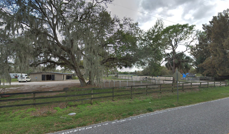
This is a portion of Graceland Ranch. Image from Google Maps

Conversely, the blog says, “[W]hile affordable housing is indeed a goal … Mr. Hines is promoting a quick fix to motivate the private construction of less costly housing, apparently without regard to how such an initiative would impact a host of significant social, environmental, economic and infrastructural concerns in a complex, radically changing area.”
Fresh Start also is encouraging people to contribute to the acquisition of Graceland Ranch.


Subscribe to the SNL


Friday, May 31, 2019

County officially drops traffic concurrency standards

Courtesy of the Sarasota News Leader


Subscribe to the SNL

County Code revision puts into effect standards for transportation analyses related to new construction, as detailed in 2016 Comprehensive Plan policy


May 30, 2019 by Rachel Brown Hackney, Editor & Publisher

Only proposed Comprehensive Plan amendments and Critical Area Plans can be subjected to more intensive traffic reviews, staff says

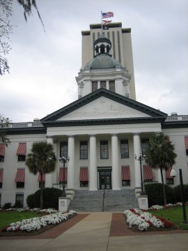
Florida’s historic and new capitols. Courtesy State of Florida

As part of its 2016 update of the Sarasota County Comprehensive Plan, the County Commission approved a new transportation policy that reflected the Florida Statute changes. That policy, 1.3.12, says, “Sarasota County shall continue to review individual applications for rezoning, special exceptions, and approvals under the Land Development Regulations for safety, adequate ingress and egress, compatibility, operational issues at impacted intersections and circulation, as provided in the County Code, but shall not apply traffic concurrency standards to them. The county will review proposed Comprehensive Plan Amendments and Critical Area Plans, and take into consideration their effects on the multi-modal transportation system and the adopted levels of service, and any need for facility improvements they cause or exacerbate.”
However, Matt Osterhoudt, director of the county’s Planningand Development Services Department, explained to the board on May 21, the commission never actually approved changes to the applicable county ordinance to reflect the Comprehensive Plan modifications.
As a result, following endorsements from eight speakers, the commission did just that, on a 4-0 vote. (Commissioner Michael Moran was absent from the meeting.)
Included among the changes is language that establishes traffic impact analysis and site access assessment requirements for specific types of projects.
Osterhoudt emphasized that “more of a robust analysis” of traffic impacts is warranted with proposed Comprehensive Plan amendments and Critical Area Plans (CAPs). Those reviews would include the adopted levels of service for the roads that would be affected, he said.
“Level of Service” refers to a driver’s assessment of how well traffic flows on a road, with “A” being the best level and “F” the worst.
Former Commissioner Christine Robinson of Venice — who had to step down from the board in November 2016 because of term limits — was among those eight people who applauded staff’s efforts to take the steps necessary to amending the County Code.

Former County Commissioner Christine Robinson. Image courtesy Sarasota County

Representing the Argus Foundation of Sarasota, which she serves as executive director, Robinson also pointed out that the County Commission adopted the use of mobility fees, “as a result of a technical report that was brought to [the board].” Those fees replaced the previously used transportation impact fees, she noted, which could be used just for the road network. Conversely, Robinson pointed out, mobility fees paid by developers can be used for sidewalks, for example.
“It’s up to you to decide how to use those [mobility] fees,” she told the commissioners.
Earlier on May 21, Paula Wiggins, manager of the county’s Transportation Planning Division, pointed out that mobility fees would not produce enough revenue to cover the implementation of the county’s 2040 Thoroughfare Plan. However, Wiggins noted, staff has plans for a mobility fee update in 2020.
Another speaker during the later public hearing on May 21, Dave Langhout, vice president of Kolter Homes and past president of the Manatee-Sarasota Building Industry Association, offered the latter organization’s full support of the changes in the Code of Ordinances. “I can’t help but just use one word,” he added: “Finally.”
The lone person who did not endorse the revision of the county regulations was Pine Shores Estates resident Sura Kochman. Her neighborhood borders the site of the planned Siesta Promenade mixed-use development on the northwest corner of U.S. 41 and Stickney Point Road.

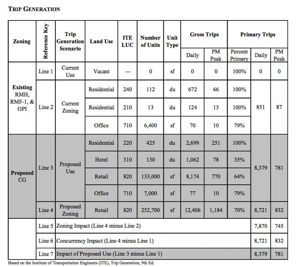
A table in a county staff report in August 2018 offers these details about anticipated traffic generation related to Siesta Promenade. Image courtesy Sarasota County

During her public hearing remarks, she quoted from a June 10, 2015 memorandum from then-County Attorney Stephen DeMarsh to the commission: “If a local government adopts a mobility fee system as an alternative to concurrency, the alternative mobility funding system adopted may not be used to deny, time, or phase an application for site plan approval, plat approval, final subdivision approval, building permits, or the functional equivalent of such approvals. Notably missing from this list are rezones, special exceptions, [developments of regional impact] and similar board-level discretionary approvals. As the statue is currently written, if the Board repeals concurrency and adopts a mobility fee system, it may not only deny Comprehensive Plan amendments because of traffic impacts, but also may deny or condition rezones and similar development approvals because of adverse traffic impacts so long as any conditions imposed do not constitute a concurrency system.”

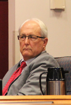
Deputy County Attorney Alan Roddy. File photo

If the ordinance changes proposed that day were approved, Kochman asked on May 21, “Does this opinion still apply?”
(Opponents of Siesta Promenade have pointed to the thousands of extra vehicles it will add to one of the county’s most congested intersections.)
Deputy County Attorney Alan Roddy, who said he believed he actually wrote the 2015 memorandum, explained that it applied to the situation prior to the 2016 update of the Comprehensive Plan. Therefore, the opinion Kochman read would not apply if the proposed amendment to the County Code were approved.
In making the motions necessary to put the changes in effect in Chapter 94, Article 7, of the County Code of Ordinances, Commissioner Alan Maio said, “I was here in 2015. It’s exactly as Mr. Roddy said. … This is not a policy change. It’s just enacting what we did in 2016.”

Courtesy of the Sarasota News Leader

Subscribe to the SNL


Monday, May 13, 2019

Audubon Vision: Jeanne Dubi on optimal uses for the public lands at the Celery Fields


Public Planning Workshop: Tuesday May 14, 6 p.m.
Church of Hope: 1560 Wendell Kent Road, 34240

Jeanne Dubi's SRQBirdAlert:

On Tuesday, May 14 at 6 p.m. at the Church of Hope, Sarasota County staffers will hear plans proposed by various groups for the Quad parcels at the intersection of Apex/Palmer Blvd at the Celery Fields. Sarasota Audubon is submitting its Audubon Woods plan for the Quad parcels.


It would buffer the Celery Fields from further development while expanding and enhancing bird habitat and providing more opportunities for passive recreation; ADA  accessible paths through a woodland are included.


We’ve targeted 2 species that used to call the Celery Fields area home: Eastern Towhee and Northern Bobwhite. We also witnessed the dislocation of Bald Eagles’ nesting areas as development encroached upon them. Creating a buffer around the Celery Fields is crucial.


As part of a wider vision for the Celery Fields and the surrounding areas, the Conservation Foundation of the Gulf Coast is developing a Rural Conservation Area plan. Once put in place, this would protect the lands east of Center Road and west of Tatum School from intense housing development. Sarasota Audubon wholeheartedly endorses this plan.


Other plans range from intense use to sensible use. Please come out to “see and hear” on Tuesday. The more we know, the more we can plan our strategies to protect the Celery Fields. Not all plans have been uploaded to the SC.gov website, but here are some.
                                                                       Jeanne Dubi, Sarasota Audubon
                                                                     Audubon Woods imagery here

Thursday, April 4, 2019

Digest for the week ending 4.6.19

Bee Ridge wastewater treatment plant

The FDEP (Florida Dept. of Environmental Protection) has issued a Consent Order to Sarasota County. It requires Sarasota to move to Advanced Water Treatment, to rid our canals and bays of nitrogen-rich discharges that feed Karenia Brevis -- Red Tide.

        How did we get into this mess? NPR has a clue.

        FDEP Draft Consent Order


The upcoming planning workshop about the future of our public lands near the Celery Fields (the Quads) is open to new ideas -- alternatives to heavy industry included -- but don't plan to propose them at the workshop -- Send them in advance, says lead planner Steve Kirk.


Celery Fields Recreation Area


Critical Area Plan Workshop Information

Last fall, the Board of Sarasota County Commissioners directed Planning to undertake a new Critical Area Plan study of our public lands at the Celery Fields known as the "Quad Parcels," or just "Quads." It's an opportunity to take a new look at what is there and what might be possible, if, for example, new conditions, or a change in the roads, were in place.
Critical Area Plan Scope 

On Jan. 29, the Planning Dept. issued a memorandum outlining the Scope of Work for this study. That memo is here.

Lead County Planner Steve Kirk has been consistently helpful in answering our questions about the process. The County is looking at a date in mid-May for the workshop, probably to be held in the evening. The date and venue have not yet been finalized. 

Note: Mr. Kirk says staff will review and discuss with the public proposals previously submitted by the Fresh Start Initiative. Also, some new proposals are being developed within our communities. Anyone who has a new proposal is invited to submit it to Mr. Kirk at any time -- his contact information is at the end of this post.

Below are the responses thus far to our queries:

The public workshop will be an informal event and staff will be flexible in how it concludes. Timing speakers would be unnecessary, however, domination of discussions will be discouraged. 
Any input regarding CAP should be directed  to me at my address, phone number or email address below. The intent  of the workshop is to present to the public all the information the staff has at the time, and then hear ideas and feedback from those in attendance. The staff presentation will include any ideas related to the CAP or the County properties previously provided by the public, including those previously put forth by Fresh Start.  We will also include anything else we receive  prior to the workshop.  It will be made clear in our presentation that we will continue to take public input, and will welcome conversations on the CAP issues after the workshop, and until the CAP study is completed. 
The staff is beginning the study and preparing for the public workshop. 
We will record audio of the workshop.   
The work of the study will continue after the public workshop and should be completed within the 9 month period.  
As stated in the scope of work, once completed, a presentation and discussion of the study will be scheduled with the County Commission. What happens after completion of the study is at the discretion of the Commission and I would not speculate on what action they may take. However, should the Commission direct staff to amend the Critical Area Plan or rezone any of the County owned properties, the public hearing processes as required and outlined in the UDC and CAP regulations will be followed. The County owned “Quads” parcels are all zoned Open Use Rural (OUR), and industrial uses are not permitted. The establishment of an industrial use  would require a change of zoning to a district permitting such use. 
If the Board directs staff to rezone any of the parcels, staff would prepare and process a rezone application as required by the UDC including all necessary documentation. The preparation and processing of such an application, including public hearings, would likely take a minimum of 6 months. The CAP study authorized by the Board, on which we are now working, is not an application to amend the CAP or rezone any property.  It is intended to provide the Board with information to inform decisions in the area of the CAP. Notice of the public workshop will be posed on the Planning and Development Services Calendar on-line at  https://www.scgov.net/government/planning-and-development-services/pds-calendar.This calendar will link to documents related to the workshop. I cannot at this point tell you exactly when this will be posted, but approximately 2 weeks before the workshop.

Steve Kirk, AICP, ASLA 
Planner III 
Sarasota County Planning Services 
1660 Ringling Blvd, Sarasota, FL 34236 
Office: 941-861-5202 
Email: skirk@scgov.net
 Lo Res 2Color RGB No Signature.jpg 

Friday, March 8, 2019

Primer on Gabbert's Waste Transfer Facility

What can we learn from the processes that led to James Gabbert having the county's blessing to build a waste transfer facility in the wrong location? How can we do better next time?


Gabbert buys and receives special exception for Waste Transfer Facility (WTF)


April 1, 2015: Deed of purchase of six-acre transfer site: Shows that Gabbert's TST Ventures paid $100,000 for the parcel. The Appraiser shows the same property had previously sold on Sept. 2, 2004, for $840,000.

County Commission Public Hearing of Aug. 20, 2015, at which WTF was approved. Hearing begins at the 1:52 minute point.

Gabbert Timeline The parcel Gabbert purchased did not allow heavy industry. He and Bo Medred had to ask the Board for a Special Exception. The Timeline show how Sarasota county bent rules, created special exceptions, and paved the way for Gabbert to operate a full, open-air Waste Processing Facility on 16 acres, including a 10.6-acre parcel of public land. Only the public outcry on Aug. 23, 2017 stopped this from happening - and even then, Commissioners Al Maio and Mike Moran voted for the Waste Processing proposal.

Citizen Response

Letters, emails, social media statements from residents and businesses - small sample below, many more at link:
"I am watching everything I loved about Sarasota being destroyed by people who are supposed to represent me. This may be one of the more overt examples of putting personal gain over the voices of the people and protection of one of the only sacred spaces left in SRQ."
"I seriously doubt that millions of dollars are being spent to attract tourists to our area so they can witness poor planning.  Sarasota is rapidly turning in to the butt of an series of man-made and politically generated disasters.  We have a plastic candy cane sewage system which is decades behind where it should be, adding to the pollution in the Gulf; are experiencing over-building which is having a negative impact on existing property; we’re ignoring infrastructure such as maintaining roads, monitoring and controlling traffic flow; avoided the politics of red tide until it became one of the most costly and devastating events our area has seen.  And yet, you see fit to approve a noisy, toxic, airborne and ground water pollution-generating, debris center earmarked ‘light industrial’ near a beautiful watershed filled with wildlife and those who are seeing a tiny bit of nature in this rapidly 'pave paradise' world . . .."
"Any commissioner who received $$ from Gabbert, directly or indirectly, is compromised and should have not voted on this issue in the first place."
Sample of Gabbert contributions to Al Maio's campaign 2014

Relevant Laws

Federal and County efforts to restrain blight along the highway include:

Best Practices?

Did the Board-appointed Planning Commission or the Board itself direct staff to look at best practices in the field of waste management to mitigate the impacts of a WTF near the highway and a celebrated Nature Area? No.

What was possible? Here's a Waste Transfer Station in Seattle creatively designed to reduce noise, odors, and visual impacts -- it even includes a playground.


An alternative vision 

Beginning in December 2017, a group of citizens representing 50 HOAs sought to show the Board a better vision for the Quad Parcels next to Gabbert's WTF. The group, called Fresh Start, reported its work here.

April 25, 2018 PowerPoint - Fresh Start to County Commission

September 12, 2018 - Final Video presentation from Fresh Start


Next

Board voted to proceed with new Critical Area Plan for the Quad Parcels. The Board might seek to use this process to rezone the public Quad parcels for industrial use. The public voice might again be the only voice speaking for rational, environmentally sensitive uses that benefit our communities.
The Critical Area Plan process for the Quad parcels will include a public meeting, probably in mid-May. Anyone can be added to the notification list by simply asking - write to SKirk@scgov.net - that's Steve Kirk, the lead planner for the Quads Critical Area Plan.


Thursday, February 28, 2019

The "First Impression of Sarasota County"

The Quads -- four parcels near the Celery Fields -- are public lands. We own them, but we could lose them to James Gabbert's trucks or Bob Waechter's warehouses.

Here is the objective set in the I-75 Corridor Study, a forward-looking plan done by County Planning in 1989.


Here is James Gabbert's planned Waste Transfer Facility (WTF), approved to be built on six acres at Porter and Palmer -- on broken roads, in clear view of the highway, with the Celery Fields in the background for highway drivers to see:


WTF indeed.

Feb. 28, 2019: Two citizens met with the lead planner for the county's new process, revising the Critical Area Plan for the Quads. The planner assured us that they are willing to speak with anyone who wishes to provide input. Also, they intend to have a public meeting open to all - not yet scheduled, but likely to be set for mid-May.

Anyone wishing to be added to the notification list can send an email to planner@scgov.net or to skirk@scgov.net. Be sure to reference this Critical Area Plan process - say something like: "CAP for the Quads near the Celery Fields" and ask to be notified of all meetings and actions.


Waste Transfer Truck


Thursday, January 31, 2019

Sarasota's "park-like setting"


This is the site of James Gabbert’s pending Waste Transfer Facility as seen from I-75, with the Celery Fields in the distance. The row of trees separates Gabbert’s planned facility from the Public’s 10-acre quad parcel #2. Gabbert received his permit Jan. 31.

James Gabbert received county approval to build his Waste Transfer Facility (WTF) (six acres at Porter and Palmer next to the highway) on Thursday, Jan. 31, 2019. Mr. Gabbert's parcel is immediately adjacent to I-75. He owns his site, the small rectangle at the left side of parcel #2. The numbered parcels are public land.


Maio
The land that Mr. Gabbert purchased in 2014 did not allow this use. He asked for and received a "Special Exception" from the Board in 2015, at a "public hearing" that few if any residents of East Palmer knew about. A copy of the WTF site plan is here; related documents are here. "This is a special exception that needs to be approved," said Commissioner Al Maio, in moving it to a vote. Here's the permit letter.


Why is this a problem?
  • This is an open facility: Tall piles of construction debris will present a highway eyesore, blighting the view and character of the Celery Fields public lands (photo above).
  • This WTF will be the first thing drivers see coming through the I-75 underpass at Palmer Blvd.
  • Trucks entering and leaving the facility on Palmer by Bell Rd. could clog traffic from the industrial parks residents Palmer Blvd at the underpass. 
  • Six acres is small for such uses, and the location is just plain wrong. There's no evidence the county ever did a diligent site study as advised by the Federal EPA Guide for Waste Transfer Stations.
  • This heavy industrial use required a special exception (the land was originally zoned for light industry). This harsher use could influence future planning for the public lands at Apex and Palmer. For example, the county could consider affordable housing on the 13-acre public parcel #2 next to it - but given the WTF, they might incline to see heavy industry as "more compatible."
In short: The Board of County Commissioners used its role of public steward to create blight where none exists.

Gabbert
Mr. Gabbert's permit is granted for land adjacent to public land. That makes us all stakeholders. We can write to the County to require the developer to mitigate the negative impacts. Various kinds of mitigation are possible:


>>>>>ACTION ITEM<<<<<<


Write to your district commissioner (copying the others) and relevant county staff and demand that this incompatible plan be mitigated every way possible. 
  • attractive buffering 
  • landscaping
  • appropriate hours of operation 
  • enclosed facility (the plan calls for an open facility)
  • compatible lighting
  • sound fencing 
  • themed fencing - perhaps something linked to birding or the celery fields?
  • safe turning lanes
Email addresses:

Planning
  • Mark Loveridge - Planning and development permitting: mloverid@scgov.net
  • Matt Osterhoudt - Planning Director: mosterho@scgov.net
  • Jane Grogg - Long Range Planning: jgrogg@scgov.net  
  • County Administrator Jonathan Lewis: countyadministrator@scgov.net 

  • CC or BCC: Fresh Start: freshstartSarasota@gmail.com


Elected Officials - This land is in District 1, Commissioner Moran's district:

District 1: Mike Moran: mmoran@scgov.net
District 2: Christian Ziegler: cziegler@scgov.net
District 3: Nancy C. Detert: ncdetert@scgov.net
District 4: Alan Maio: amaio@scgov.net
District 5: Charles Hines: chines@scgov.net

All five commissioners can also be copied by using commissioners@scgov.net

NOTE: Commissioners Maio and Moran voted FOR Gabbert's larger Waste Processing Facility that the citizens of Sarasota strenuously opposed, ultimately persuading three Commissioiners - Caragiulo, Detert, and Hines - to vote against the dump in August 2017. Gabbert already had his 6-acre site approval. Mr. Gabbert and Robert Waechter have long been paying supporters of four board members (only Detert is not funded by them), and political allies of Maio in particular.

=========

Further points

At least two legal considerations ought to have been addressed during the 2015 approval process for this plan, but neither appears to have been considered either by the Board or its attorney:

1. When the Board approved Gabbert's rezone of the six acres, it ignored a county ordinance that specifically requires lands along the I-75 corridor to present a "park-like setting." The I-75 Corridor Plan Ordinance #89-35, Exhibit B, Item M, states:
In recognition of I-75 as an area of critical concern, all critical area plans within the I-75 Critical Area of Concern shall be consistent with the following where applicable:
(m) a positive image for I-75 through the establishment of quality development within a park-like setting.
2. The Board also approved Gabbert's waste transfer facility in violation of the Highway Beautification Act of 1965, which aims, among other things, to beautify highways by screening or forbidding junkyards.
The act called for control of outdoor advertising, including removal of certain types of signs, along the nation's growing Interstate Highway System and the existing federal-aid primary highway system. It also required certain junkyards along Interstate or primary highways to be removed or screened and encouraged scenic enhancement and roadside development.[2] Highway Beautification Act.
Most reasonable citizens would say that the Board's action violated both laws.


This project will blight the landscape and "brand" this area of Sarasota for tens of millions of drivers on I-75. The character of an area fortunate to have unusual natural beauty as well as recreational and international tourist activity will suffer.

The Board is about to reopen a critical area plan that concerns these public parcels. Some fear that the Board’s thinking about Parcel #2 might be impacted by Mr. Gabbert’s WTF, as well as Robert Waechter’s warehouses along its south side. The Board might find it easier to say, “Although this parcel is public land, it’s already bordered on two sides by industrial uses, so it should be industrial too.”

This is supposed to be the Board's' role as public steward and an opportunity to do something positive and of public value on our public lands.

Instead the process has been a chess game in which the public is treated like an opponent that has to be outwitted through sneaky stratagems. When planning and considering the sale of public lands, the only appropriate civic use of the term "highest and best use" is “a use that serves some significant public good.”

What are some potential public uses for these parcels?

Workforce housing
Civic center 
Outdoor arena 
History and tourist center
Athletic facilities 
Garden 
Food trucks or eatery 
New forested bird habitat to buffer the Celery Fields
Send us more ideas


Background:

County Ordinance #89-35, Exhibit B, Item M requires that development along the I-75 corridor offer “a park-like setting.”

Timeline of Board handling of WTF and Waste Processing Facility

08.20.2015: Planning Commission 8.20.2015 hearing on WTF Item 4 (video)

10.14.2015: Board of County Commissioners hearing on WTF Item 8 (video) Gabbert's waste transfer facility was approved. Moved for approval by Maio, approved by Commissioners Maio, Hines, Robinson, Caragiulo, Mason.


“Park-like setting”?
Spoonie courtesy of Chuck Behrmann